The initial concept links six distributed data-centre/greenhouse/aquaculture nodes from Kielder to Humshaugh & Chollerford, with Hexham serving as the southern grid, rail and fibre gateway.
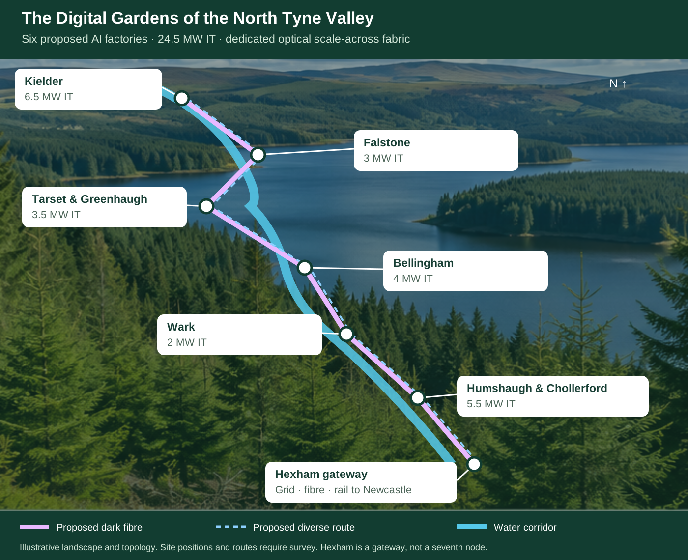
Concept map of the North Tyne corridor. Exact plots, fibre routes, substations and heat customers still require field surveys and formal connection studies.
| Community | Community scale | Illustrative data-centre capacity |
|---|---|---|
| Kielder | Rural community | 6.50 MW |
| Falstone | Rural community | 3.00 MW |
| Tarset & Greenhaugh | Rural community | 3.50 MW |
| Bellingham | Rural community | 4.00 MW |
| Wark | Rural community | 2.00 MW |
| Humshaugh & Chollerford | Rural community | 5.50 MW |
| Total | — | 24.50 MW |
Site capacities are screening assumptions. Population counts are not used in the Version 8 carbon calculation; community catchments and participating households require validation.
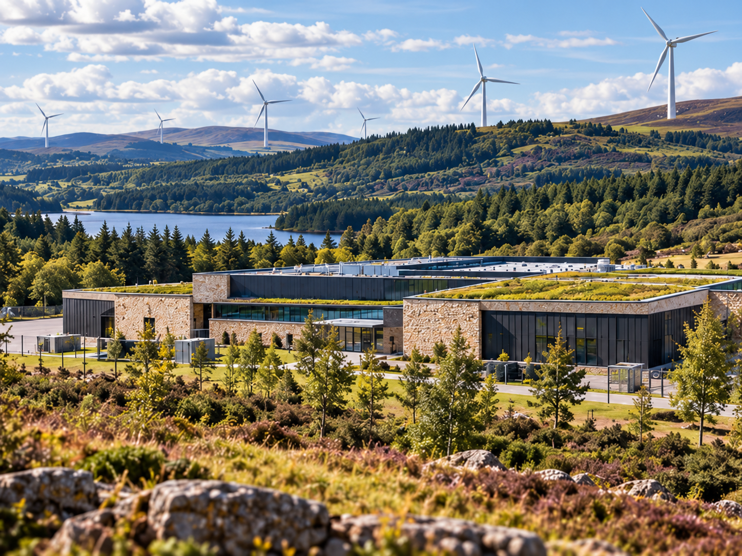
Using the two supplied Spanish site plans as design references, V6 adapts the concept to a North Tyne setting in English. The screening centre shown is approximately 55.143° N, 2.251° W (about OS grid NY 841 832) near Bellingham and the B6320. It is a geographic screening reference only — not a selected parcel, land offer or planning application.
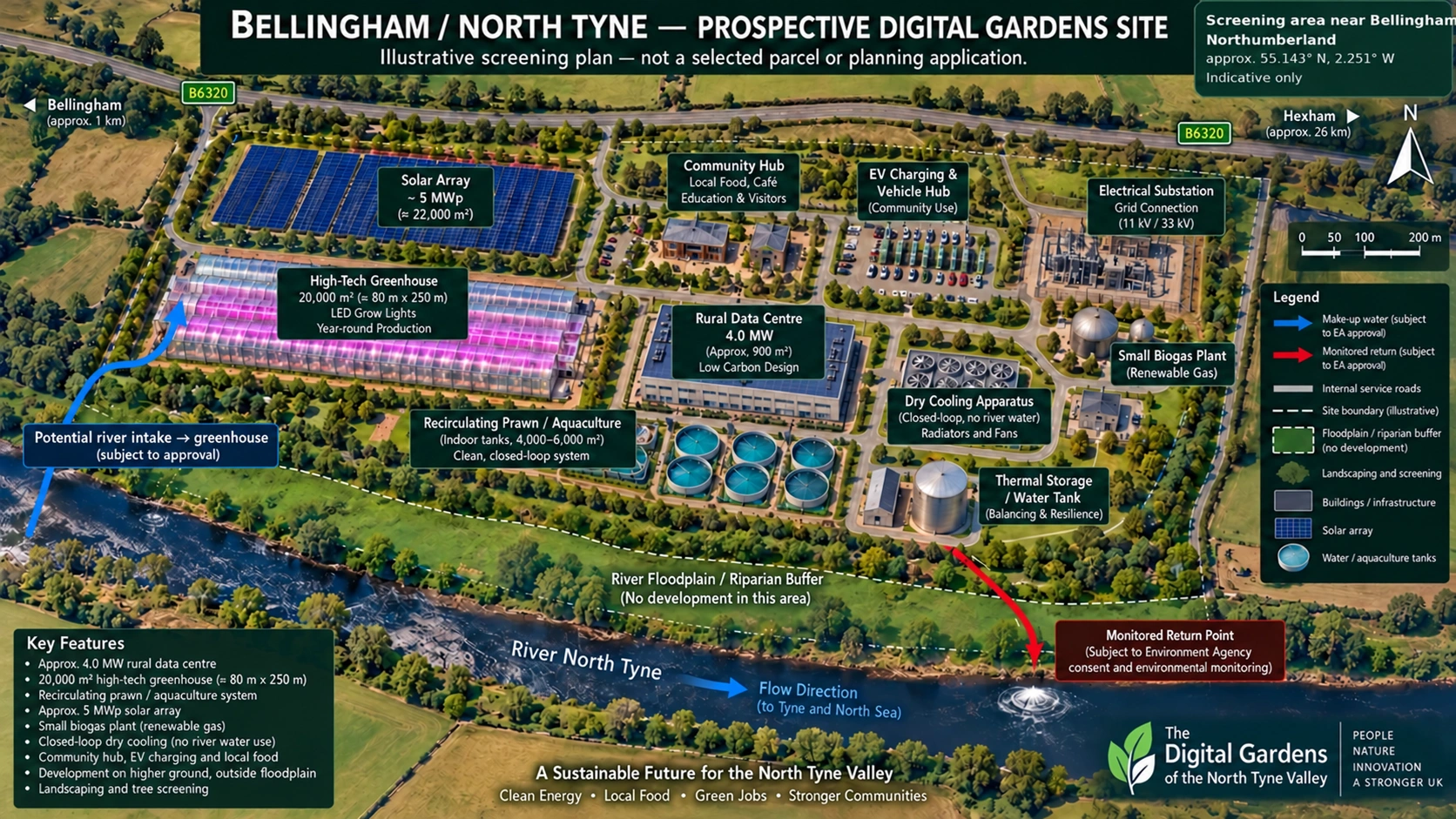
No mill: unlike the Spanish reference concepts, the North Tyne version assumes no flour mill, mill race, restored mill or mill-to-data hydro line. The river is shown only as the local watercourse and ecological/flood constraint; the base cooling concept remains closed-loop dry cooling.
Northumberland's public flood studies identify wide areas beside the River North Tyne and Boat Road as Flood Zone 3. For that reason, the V6 concept places all major buildings on higher ground and reserves the river edge as a landscaped no-build floodplain/riparian buffer.
The plan combines an illustrative 4.0 MW rural data centre, a 20,000 m² high-tech greenhouse with LED light movers, recirculating prawn/aquaculture tanks, an approximately 5 MWp solar array, thermal storage, a small biogas plant, EV charging/community vehicles and a grid connection compound.
The historic South of Bellingham development area used in public flood studies is only 2.9 ha and the Foundry Road employment area is much smaller, so this drawing is not a claim that the full campus fits either historic boundary. A real site would require landowner agreement, survey, planning review, site-specific flood modelling, ecological assessment, grid/fibre studies and any Environment Agency consents.
Public screening references: Northumberland Local Plan 2016–2036 and the Level 2 Strategic Flood Risk Assessment. The latter records the South of Bellingham screening area at grid reference 383955, 583169 and E02 Foundry Road at 384084, 583470.
The six illustrative nodes total 24.5 MW: Kielder 6.5, Falstone 3.0, Tarset & Greenhaugh 3.5, Bellingham 4.0, Wark 2.0 and Humshaugh & Chollerford 5.5 MW. The earlier 35 MW schedule is superseded. Dedicated dark fibre and a proposed diverse route connect these nodes to the Hexham/Newcastle gateway. Synchronous AI training requires measured scale-across performance.
Distributed inference and data processing are straightforward candidates. Any claim of synchronous large-scale AI training across the valley would require measured latency, bandwidth and accelerator-fabric validation.
Kielder Water is a major strategic reservoir on the River North Tyne. Any project abstraction, impoundment, discharge or river interaction would still require the relevant Environment Agency and water-company permissions.
The engineering preference is closed-loop cooling, high-recirculation greenhouse irrigation and recirculating aquaculture so that the project creates as little additional water demand as practical.
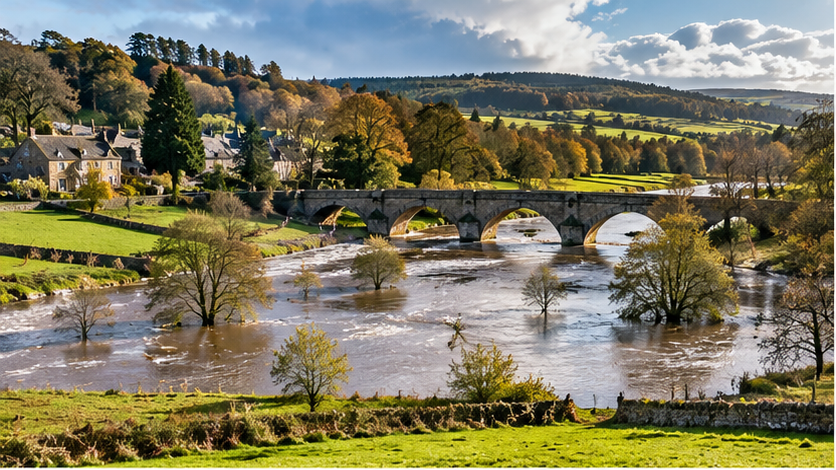
Before any site is selected, abstraction availability, ecological constraints, flood risk and discharge conditions would be checked with the Environment Agency and Northumbrian Water.
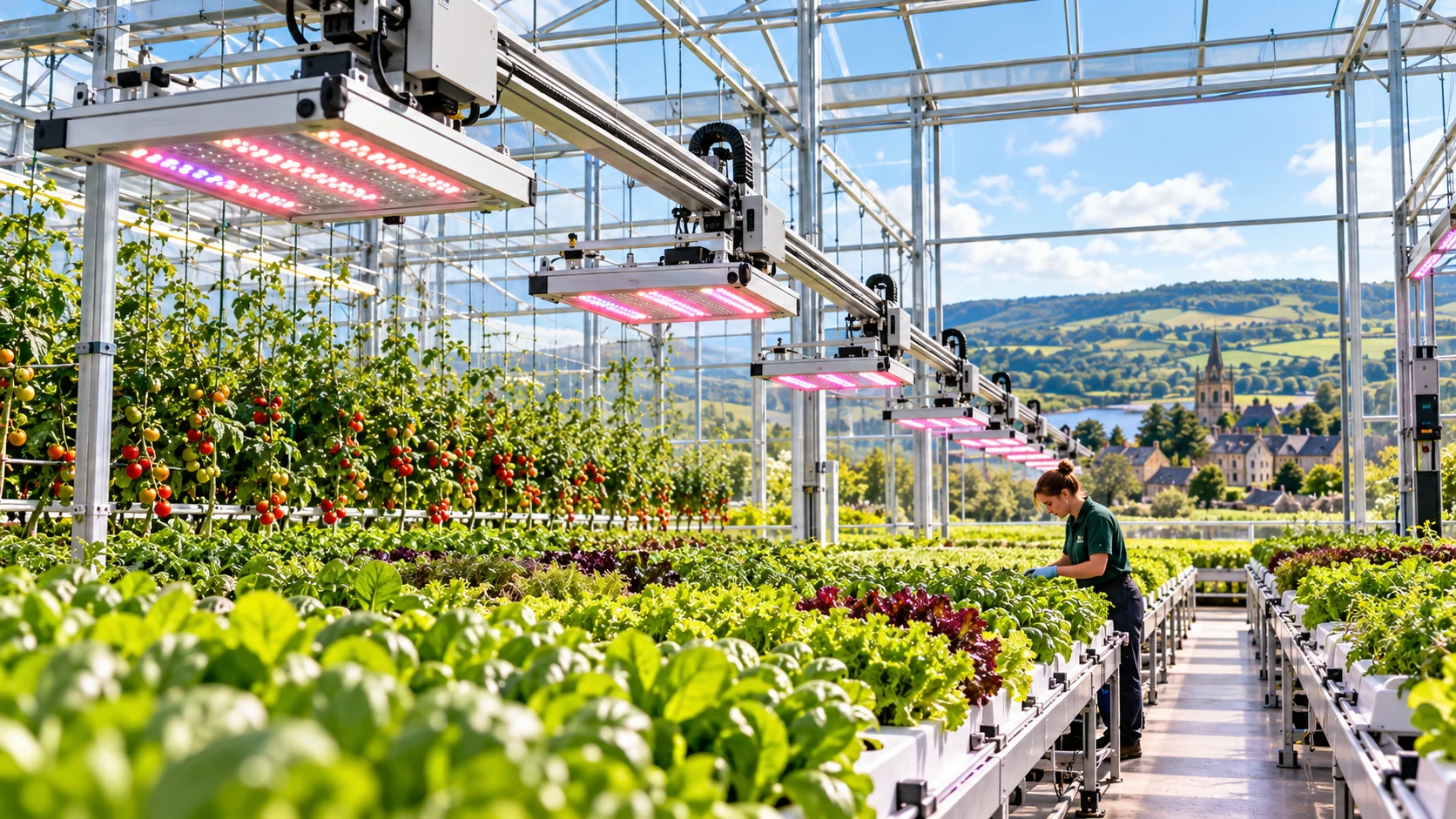
Liquid-cooled computing can provide a steady stream of low-temperature heat for greenhouses, aquaculture, district heating, hot-water pre-heating and crop drying.
Not every megawatt of heat will find a useful customer every hour. The design therefore matches temperature, seasonality, distance and thermal storage site by site.
All capacities on this page are concept-stage screening figures — not grid offers, abstraction licences, planning consents or construction commitments.
The Digital Gardens aims to demonstrate that geographically distributed AI factories can deliver useful computing while returning server heat to local food production and communities, setting a new standard for data centres.
NVIDIA Spectrum-XGS Ethernet extends Spectrum-X with scale-across networking to connect multiple data centres into a unified AI factory. The proposed dedicated dark-fibre optical fabric would carry that traffic between the six North Tyne nodes; dark fibre is the physical carrier infrastructure, while NVIDIA supplies the networking technology.
The project would test distributed inference and training, collective-communication performance, end-to-end latency, bandwidth, resilience, heat use and carbon performance. Making conventional mega data centres obsolete is the demonstration goal. It has not yet been established by this proposed project, and no NVIDIA partnership or endorsement is implied.
NVIDIA Spectrum-X and Spectrum-XGS · NVIDIA technical explanation of scale-across networking